Henson Gap Primary LZ
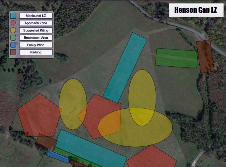
The upper strip, located at the southern end of the field, slopes upward toward launch in its southern corner. It is fairly level in its western corner bordered by large electric transmission lines (NW) and Davis Loop (SW). From here the field slopes down to the north, along a fall line that divides the upper strip from the lower strip to a big flat bottom comprising the majority of area.
Although the upper strip will be used by many pilots in a strong north cross, the wide flat bottom area may be easier to negotiate in these conditions.
Potential Obstacles
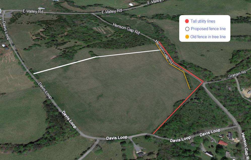
There have been taller utility poles installed on the north side of Henson Gap Road across from the north end of the Henson Gap LZ. In addition, new lines have been added across the NE side of the Henson Gap LZ which are hidden by the treeline.
The north end of the field has an old barbed wire fence in the treeline.
A new fence will be added on the West end of the LZ sometime in January 2026, be sure to check or ask for updates.
The Henson Gap landing zone (LZ) is located in the field north of Davis Loop and south of Henson Gap Road. View in Google Earth
If you should get stuck just south of the primary LZ, there are some options for an emergency landing. We hope you will never need to use them, but here is some useful information regarding those fields.
Note the launch pin in the lower right-hand corner of the first photo and fields circled in red
Austin Fields

The field closest to launch is long and narrow with power lines on the south side and on the west side. Best to land closer to the road.

The field below shows the power line and poles in the field by the house.

The field below is further out from launch and has power lines and poles on the south and west ends. The left side of the field slopes up to the west and is very rutty. Again landing closer to the road is the best option.

Woerner Fields
These fields are directly across Davis Loop from our primary LZ. We do not encourage you to land in these fields unless it’s an emergency. We have a long-standing relationship with the Woerner family and they understand that things happen, but we do not want to wear out that relationship.

The areas in purple are bowl shaped fields and slope uphill.
If landing in these fields be aware of the gradient with any wind or better yet, land on top of the hill.
All fields are surrounded by fences, please DO NOT climb over any fences, you will have to go under.

Other Important Notes